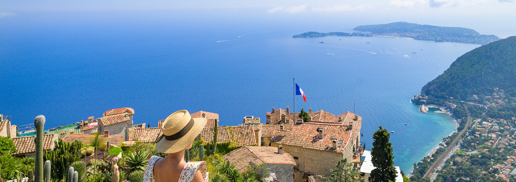
panoramas between the sea and the mountains : the mid-country
30 January 2024
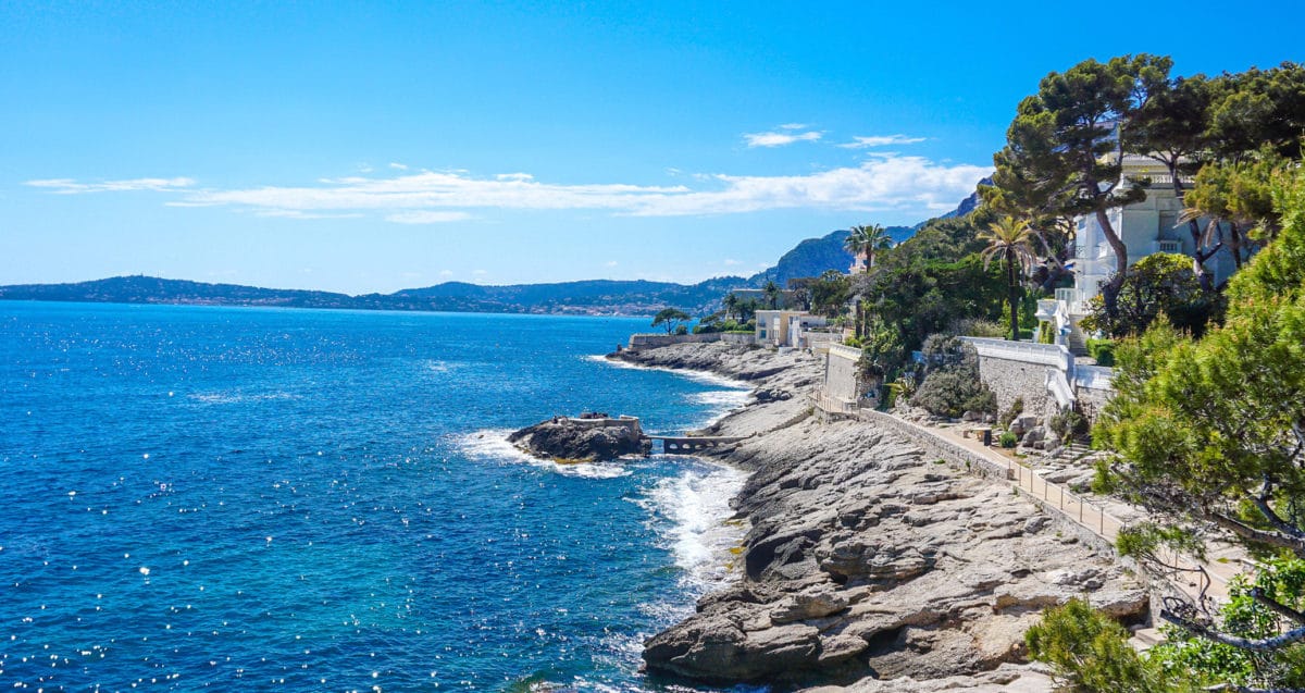
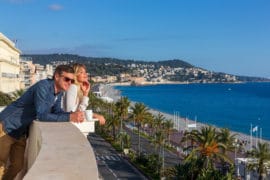
Not far from the coast, you can discover villages perched on hillsides that offer extraordinary views of the Mediterranean Sea and the surrounding mountains.
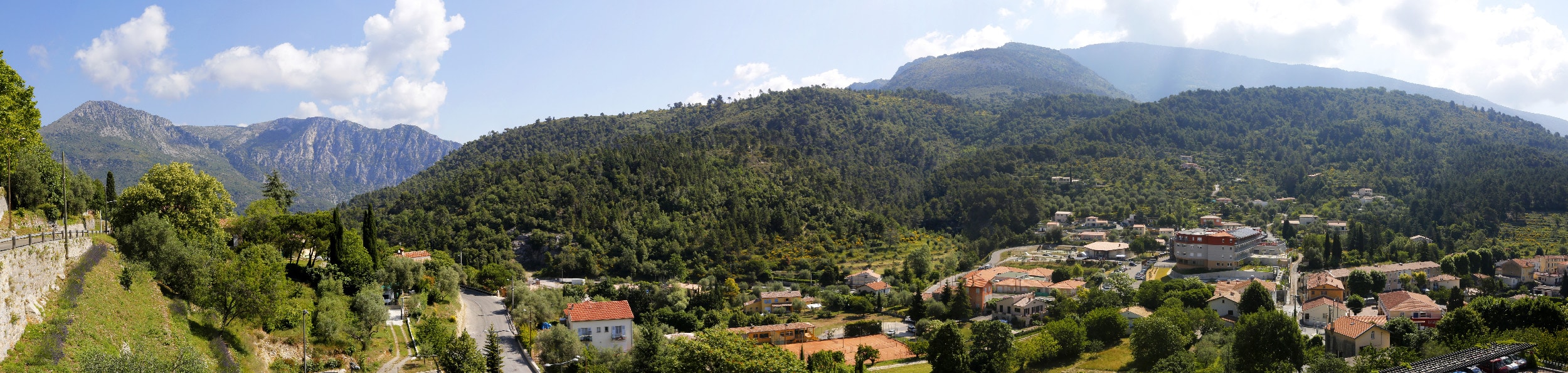
It is often at an altitude of less than 1,000 m that walkers explore the paths of the Moyen-Pays, located here as a real link between sea and mountains.
In the hinterland of Nice, this territory drained by the Var and by numerous rivers is a green setting, and acts as a green lung for the Côte d’Azur.
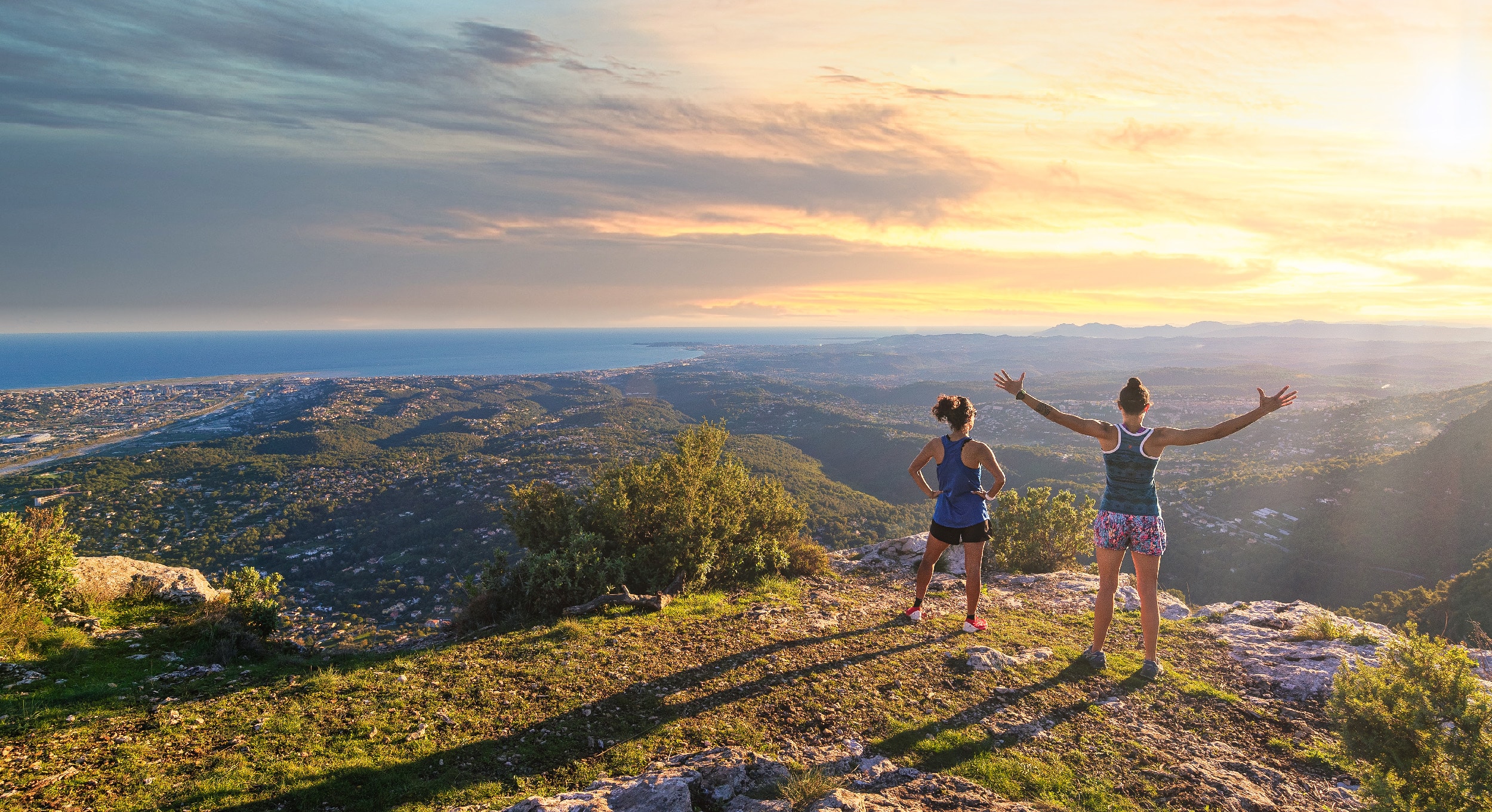
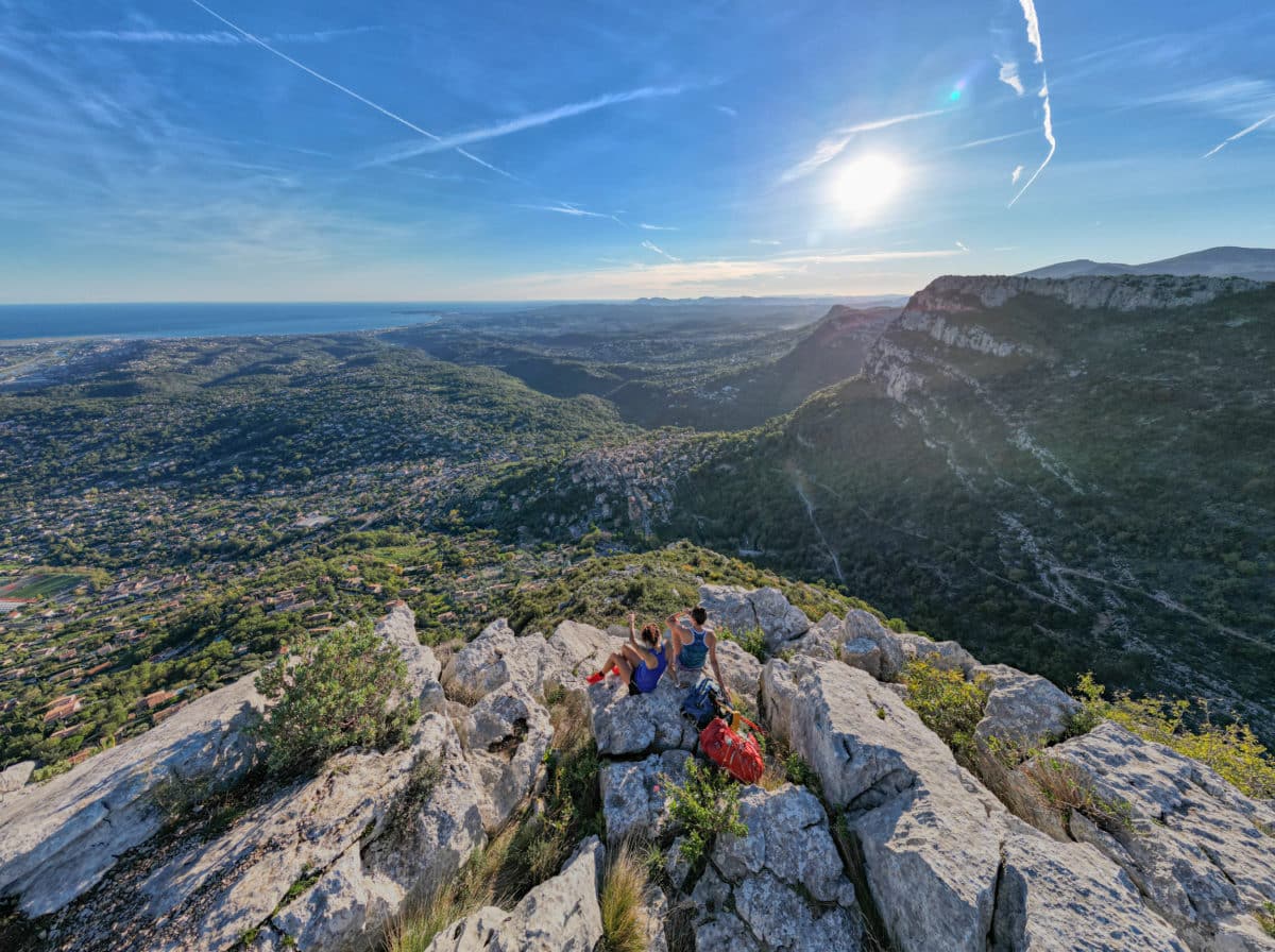
Promontories, rocky peaks and passes shape this Middle Country, and make it a playground in its own right, within easy reach for everyone. It dominates the coastline as the envious little brother of the Alpine mountains.
It is the ideal place to discover the most beautiful panoramas, as they often offer an exceptional 360 degree view. From the blue of the Mediterranean to the green of the surrounding area and then to the white of the snowy peaks.
The Baous : 4 inseparable friends !
About ten kilometres from Cagnes-sur-Mer, to the north, and visible from the coast and the motorway, four silhouettes trace the first relief of the Alpes Maritimes on the horizon. They are the Baous*. Baous des Blancs and des Noirs, Baou de Saint Jeannet and Baou de la Gaude. Together they form a small chain which is very interesting for the walker. The Grand Parcours des Baous is a beautiful hiking route linking 9 communes attached to this first mountain landscape.
Whichever baou* you take for a walk, it will offer you a breathtaking panorama of the coastline. The Baous des Blancs and the Baous des Noirs protect Vence like a shield and can be discovered on foot from the town centre for the more experienced hikers. It is necessary to pass by the Baou des Blancs to discover the Baou des Noirs. True twins, they are surmounted by a cross reminding us of what they are named for: brotherhoods of the White and Black Penitents who climbed up to these rocky peaks on pilgrimage. The exceptional view of the coastline stretches from Nice to Cap d’Antibes where the Estérel can be seen behind. The Baous des Blancs and the Baous des Noirs are separated from the others by a deep valley at the bottom of which flows the Cagne.
Rendezvous in the village of Saint-Jeannet, built at the foot of the Baou, the most characteristic of the four. A very popular climbing wall, the Baou de Saint-Jeannet, visible from the coast, is a treat for climbing enthusiasts. People come from abroad to challenge it. It is THE most important climbing site on the Côte d’Azur, in terms of the number of big routes and ruts. No less than 50 big routes are proposed on its big face. But you don’t need to be an expert to try it. In the village, there are guides to introduce you to this practice. For those who love a breathtaking panorama, nothing could be easier, park at the entrance to the village and set off to conquer the baou via the village. It is from the small wash house that the path starts. Although steep at the start, this ascent to the summit is accessible to all. Once up there, hold your breath, because the landscape is breathtaking!
In another style, its sidekick: the Baou de la Gaude. Accessible from the car park in the village of Saint Jeannet, the slightly less arid hiking path will lead you to another panorama. With a view of a very Provençal nature, it leads you to the Gros Chêne, one of the most emblematic of the South of France, which is said to have been a sacred oak tree in the past.
*Baou: Provençal term meaning rocky peak with a flat top, shaped like a molar
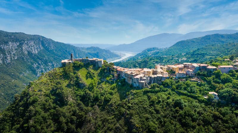
Le Broc, Bonson and Gilette: in the west of the Var
Perched on a spur dominating the confluence of the Var and Estéron rivers, Le Broc is a village situated at an altitude of 450m offering a magnificent panorama over the Var valley. A picturesque little village about thirty kilometres from Nice, it is a good place for walking, with paths offering beautiful views of the olive groves or a series of small gardens and woodlands that give the view a real landscape quality.
Bonson, which takes its name from the Niçois Bausse (steep rock), is a village overlooking a wide panorama where the Var meanders in its bed limited by dykes. What makes this viewpoint special is the landscape: on one side, a short plain extending into wooded limestone slopes, on the other, gently sloping terraces planted with olive trees. All this frames the river in a framework of shades of green, from the greyish olive tree to the deep, dark green of the cypress. One is small and stocky, the other is majestic and proud, which gives a precise relief to the picture.
Gilette overlooks the Var valley, on the road to the ski resorts. Go there to admire the view at over 450m. From there, a very beautiful hike starts which hides nature and caves** in its lair. On its way, panoramas open up to you and allow a remarkable observation of the Estéron gorges. You are then on the balcony path above the gorges… where typically Mediterranean vegetation unfolds before your eyes: pines, holm oaks, fig trees, vines, lentisks and cineraria cling to the slopes formerly cultivated for olives and oil and to the rock faces. This hike takes you to the Clue de la Cerise, where a medieval bridge was used as a set for the 1997 film “Le Bossu”.
**Clue : synonymous with cluse in the Midi. A steep and narrow passage, dug out of a mountainous line, connecting two valleys.
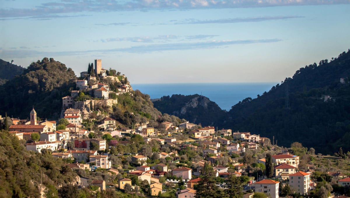
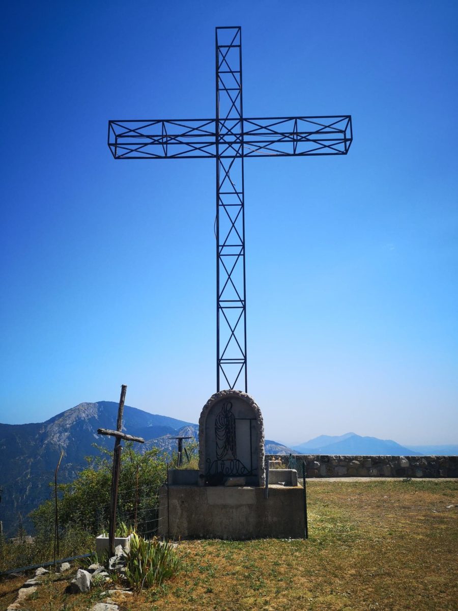
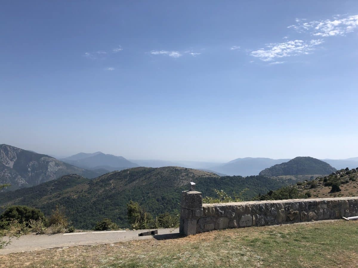
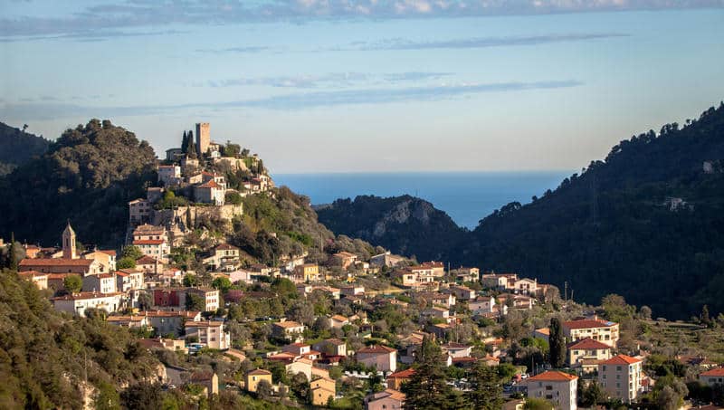
Utelle and its Madonna: a spectacular panorama!
The Madonna of Utelle is a sanctuary perched at the top of a mountain overlooking a whole landscape, from where you can see the Mediterranean to the south, 36km away, and to the north the birth of the Mercantour. A real open-air belvedere, this place with a sacred legend leaves no one unmoved by its atmosphere and its climb.
The Virgin Mary appeared to Spanish sailors in the year 850 to commemorate the miracle of saving them from a shipwreck, and this sanctuary was recognised by the Roman papacy. Famous for the miracles that take place there, the place, built with a chapel, is surrounded by green nature with a 360° view.
On the plateau, you can see small five-pointed stars. According to another legend, it was Mary who scattered them on the summit at night for passing pilgrims. But scientists have a more rational explanation: they are fossils of marine animals called Crinoids or Sea Lilies, which covered the ground 140 million years ago, when this site was under the sea! This is also why the view is extraordinary. At the crossroads of two worlds, marine and mountainous, sacred and natural, it offers a unique personal poetry.
For keen walkers, it is worth noting that Utelle is part of the long-distance hiking trail 5 (GR 5) linking the North Sea (at Hoek van Holland in the Netherlands) and the Mediterranean Sea (at Nice), which is almost 2,200 kilometres long.
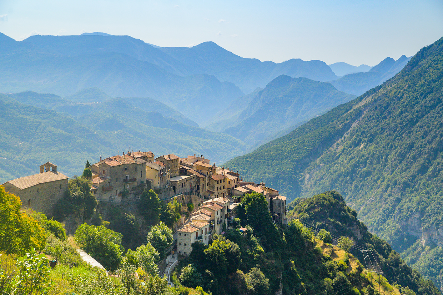
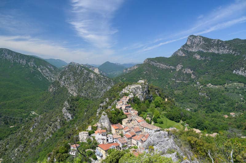
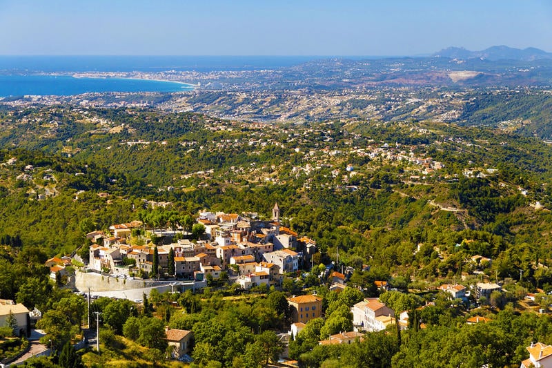
Levens or the paths with a thousand faces
Culminating at an altitude of 600m, above three rivers (the Estéron and Vésubie, and the Var coastal river), the perched village of Levens is surrounded by several peaks. Mont Férion, at 1412m, gives it an ideal geographical position to make it a starting point for paths, each as picturesque as the next.
Let’s go and discover the panoramic views galore:
The ascent of Mont Férion from Levens offers a superb view of the sea and the Estéron river. When you reach the top, a whole landscape on the Paillons side spreads out and for the most curious, as a gift for the efforts made to get up there: the Mercantour. You will see its relief revealed in all its splendour, between two trees.
The Col du Dragon circuit is very diversified (path, track, road), and very interesting to do in autumn or spring. Its advantage is especially on the way back, which offers a plunging view of Levens while passing not far from magnificent villas in Gieinnanova. By bike, this circuit offers one of the most beautiful singles in the metropolitan area.
Another loop to be done by mountain bike, starting from the Grand Pré, is Mont Arpasse, whose summit is an exceptional viewpoint overlooking the plain and the mouth of the Var. At its highest point, a path leads north along the ridge line, giving a breathtaking view of the village of Bonson. A little technical, it leads back to the Arpasse ravine. However, an easier variant is possible by taking a track on the right before the summit of Arpasse.
Levens is thus anchored in a setting where each corner takes on a different face. An exceptional land for hiking in all seasons but also for cycling, this commune is often a must for the Festival Outdoor 06.
Other striking views, a few kilometres from Nice
On one side the sea, on the other the mountains. Wherever you look from the heights of Tourrette-Levens, the panorama is exceptional. Curled up around the square tower of its ancient castle, which, according to history, was one of the most beautiful in the region, the village seduces at first sight. Here, you don’t need to be a hiker to take in the panorama. The village, built in tiers, offers secret views of the outside world in its recesses. A large medieval festival is held here every year in April.
On a promontory lined with olive and fig trees, overlooking the city of Nice, Falicon seems to watch over the Côte d’Azur capital. Behind its ramparts pierced by fortified gates, the village can be discovered by calf power, but the gentleness of the place makes you forget the steep ascent towards these colourful houses. Once at the top, from the Bellevue plateau, the panorama is simply breathtaking.
Aspremont, erected in a spiral, also deserves a little breath and legs to discover it, but once climbed, the view on the Grande Bleue is absolutely impressive.
La Roquette-sur-Var, whose old centre is a perched village in itself, is located at the top of a peak overlooking the Var. The historic village is made up of houses dating from the 16th and 17th centuries, while the hamlet of Baus-Roux is located on the RD 6202, along the river and offering a décor of old factories and lime kilns. Very nice walk from the bottom of the village to the top, which offers a remarkable view of the whole Var valley. Drinking water and orientation tables on the belvedere before walking back down at leisure. This walk is however very slippery in wet weather.
Finally, Castagniers, which is accessed by road via picturesque winding bends in the hillside, amidst umbrella pines, is a peaceful village overlooking the Var valley. Superb walks and hikes are possible from the village, but it is undoubtedly the one leading to the summit of Mont Cima at 878 metres that will reward your physical efforts with a magnificent panorama. Don’t hesitate to stop at the Cistercian abbey of Notre-Dame-de-la-Paix: it is possible to buy home-made confectionery (chocolates and jams) made by the sisters of the convent.
For more information or to go further:
Climbing guides :
- https://lesgeckos.fr/ group of independent guides with the Marque Qualité Tourisme and Famille Plus labels
- La Baoutique, 48 Rue du Château, 06640 Saint-Jeannet
You must also explore